Satellite remote sensing has become an integral part of our lives and can be used in everyday activities. Together with GPS and GIS, it provides a platform for monitoring our atmosphere, changes in the landscape, surveillance of remote areas, aerial photography, and road mapping.
The data collected and provided by satellites is vital for software ag fields monitoring. These crop monitoring systems allow users to analyze, manage, and plan activities on their farms. So, we have software developers to thank for such technologies because, without their expertise, these tools would be no different from any other farm equipment that needs to be operated by a human.
Smart farming software helps farmers and landowners reduce the workload of their staff and increase the productivity of their farmers.
EOS Data Analytics (EOSDA)
EOSDA is one of the best AI-powered satellite imagery analytics providers that helps users make informed and better business decisions in more than 22 industries. However, they are mainly focused on agriculture and forestry. They combine satellite data with AI capabilities, including machine learning algorithms, to accurately determine the state of crops on a farm or trees in a forest. Their main goal is to provide decision makers with precise data to increase productivity and use resources efficiently.
EOS Crop Monitoring

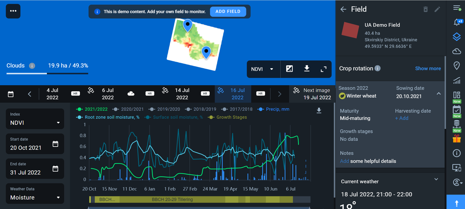
EOS Crop Monitoring is an online satellite-based smart farming tool created by EOS Data Analytics (EOSDA) to help farmers use resources more efficiently and increase yields . This tool is the go-to when you need to integrate different types of data (crop rotation, climate conditions, scouting reports, soil moisture, vegetation indices, and wilting plants monitoring, and many others) in one central hub.
Regular satellite crop monitoring ensures that issues with plant health can be detected in a timely manner and mitigated. Having the ability to detect these issues in an early stage speeds up the decision-making process, reduces workload, costs, and increases yields.
EOS Crop Monitoring has a Team Account Functionality where field owners, insurers, scouts, and other clients can see vital information about the crops and fields from the same account. The administrator can also decide who has permission to view this data by changing the accessibility level of each user.

The platform also makes scouting much easier as it helps to guide scouts to a precise location of problem areas. This information will save time and effort for scouts when carrying out field inspections. Scouting tasks can be set online with the help of satellite maps, and the assignee will immediately get a notification. The scouts can use the mobile version of the app when in the field, even without internet access. It helps them to add reports and images of scouted areas, eliminating the need to carry huge equipment along.
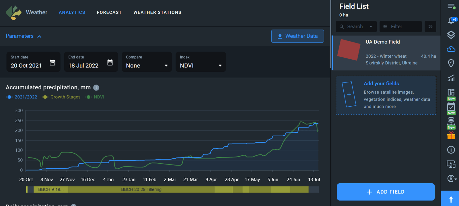
A 14-day weather forecast, coupled with historic and crop data available since 2008, provides farmers with the information needed to better plan their farming operations, such as planting, irrigating, fertilizing, spraying, and harvesting.

Users can generate productivity and vegetation maps on the platform based on vegetation indices data. It helps farmers know to perform variable-rate applications of seeds, pesticides, and fertilizers. This reduces costs and ensures the efficient use of farm resources for a better crop yield.
Using vegetation indices like NDVI, farmers can get important information on the state of their plants. It helps them make informed decisions in a timely manner.
EOS Crop Monitoring API and its features
Using Crop Monitoring API, developers can integrate data from different satellites present on the EOSDA platform and more. The detailed API documentation helps for fast integration of functionalities which are currently lacking in the product, including satellite imagery, analytics, and weather data.
Integration of satellite imagery enables obtaining satellite pictures of your area of interest (AOI) from different sources and applying various indices to them, such as NDVI, MSAVI, and many others. The users can also apply custom vegetation indices created independently based on the presence of necessary spectral bands a satellite can sense.
The API also allows for accessing the necessary data on a particular AOI, be it a small point or a large area on the map. And the possibility to apply cloud masking ensures higher accuracy of satellite imagery. More so, the API offers statistics on soil moisture in your AOI since 2016 and provides elevation data for any point on the map.
Thanks to integration of weather data, users will be able to access historical weather to detect any patterns and get a 7-day weather forecast to help plan related activities. Other weather parameters available via weather data integration include temperature, humidity, wind, precipitation, and more.
EOS SAT
EOSDA will be the first among companies that have expertise in satellite imagery analytics and its implementation in software products to launch the first true satellite constellation that is focused on farming and agriculture. By 2025, they intend to send seven optical satellites into the Low Earth Orbit. The constellation will have eleven agri-related bands, making it perfectly effective specifically for agricultural purposes. EOS SAT will provide farmers with detailed insights of their farm processes through EOSDA products, helping them make better business decisions.